


TRIEVE - TAILLEFER - petit Taillefer

JMHRX2
User
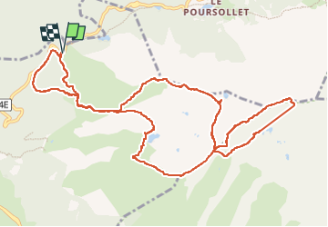

Length
13.5 km

Max alt
2682 m

Uphill gradient
1075 m
Km-Effort
28 km

Min alt
1690 m

Downhill gradient
1068 m
Boucle
Yes
Creation date :
2022-09-21 08:05:09.405
Updated on :
2022-10-12 07:09:06.135
3h48
Difficulty : Very difficult

FREE GPS app for hiking
 SityTrail
IGN / Geographical institutes
SityTrail Plus
The world is yours!
About
Trail Walking of 13.5 km to be discovered at Auvergne-Rhône-Alpes, Isère, La Morte. This trail is proposed by JMHRX2.
Positioning
Country:
France
Region :
Auvergne-Rhône-Alpes
Department/Province :
Isère
Municipality :
La Morte
Location:
Unknown
Start:(Dec)
Start:(UTM)
726212 ; 4992058 (31T) N.
Comments